The California Coastal Geoportal
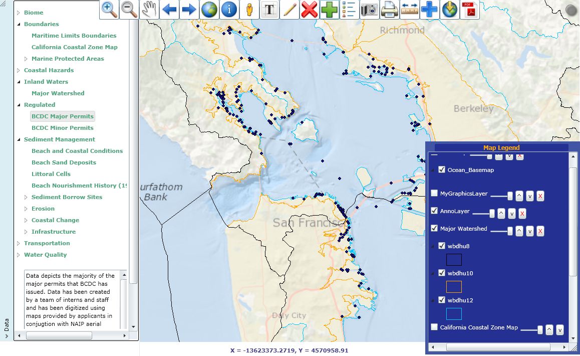
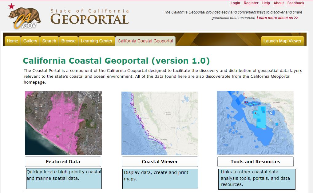 The California Coastal Geoportal makes it easy to discover, use and distribute geospatial data layers that are relevant to the state’s coastal and marine environment. Designed for state analysts and accessible to the public, the Coastal Geoportal features an index of select data layers, a desktop viewer, and links to other online tools and resources.
The state of California and its partners have made significant investments in coastal and marine data collection, developing seafloor and shoreline maps and other ecological and socio‐economic data to support decision-making in the coastal and marine environment. However, many potential users of such data find it difficult to keep abreast of these analytic resources. The Coastal Geoportal attempts to remedy this situation by:
 (1) providing a one-stop clearinghouse designed to meet the needs of coastal and marine state agency staff and the interested public,
(2) ensuring that the best and most up-to-date information is available for informed regulatory decisions, as well as the planning and scoping activities that lead up to these decisions, and
(3) relying on the guidance of the California Coastal and Marine Geospatial Working Group, a collective of agency and non-profit representatives who are dedicated to refining the process and promoting the use of the Coastal Geoportal for state agency needs.
The Coastal Geoportal may be accessed at https://gis.cnra.ca.gov/portal/coastal/. please note you will need Microsoft Silverlight and a compatible web browser to run the viewer.
The California Coastal and Marine Geospatial Working Group
The California Coastal and Marine Geospatial Working Group, in addition to guiding the development of the Coastal Geoportal, promotes collaboration between coastal and marine agencies and non-profits and the State’s Geospatial Information Officer. The Working Group is a formal subcommittee of the California GIS Council. Workgroup members include the technical managers and users of coastal and marine geospatial data from the various California state agencies and related non-profits.
Current Membership as of 5/29/2014:
| Aaron McGregor | California Ocean Science Trust |
| John Carotta | California Technology Agency |
| Cassidy Teufel | California Coastal Commission |
| Greg Benoit | California Coastal Commission |
| Clif Davenport | California Geological Survey |
| Eric Gillies | California State Lands Commission |
| Holly Wyer | California State Lands Commission |
| Steve Goldman | California Department of Fish and Wildlife |
| Javier Del Castillo | San Francisco Bay Conservation and Development Commission |
| John Helly | University of California at San Diego |
| Alyssa King | U.S. Army Corps of Engineers |
| Matt Armsby | Resources Law Group |
| Peter Jarausch | California State Coastal Conservancy |
| Erin Reddy | California Natural Resources Agency |
| Sara Aminzadeh | California Coastkeepers |
| Paulo Serpa | California Department of Fish and Wildlife |
| Steve Steinberg | Southern California Coastal Water Research Project |
| Tim Doherty | Coastal Services Center, National Oceanic and Atmospheric Administration |
| Tim Reed | Gulf of Farallones National Marine Sanctuary |
| Tom Lupo | California Department of Fish and Wildlife |
| Tony Hale | San Francisco Estuary Institute |
| Chris Besenty | California Ocean Protection Council |
Contacts
The Coastal Geoportal is a partnership project between the California Department of Technology and the California Coastal and Marine Geospatial Working Group, and facilitated by the Ocean Protection Council.